COURSE MAPS
IN MINUTES.
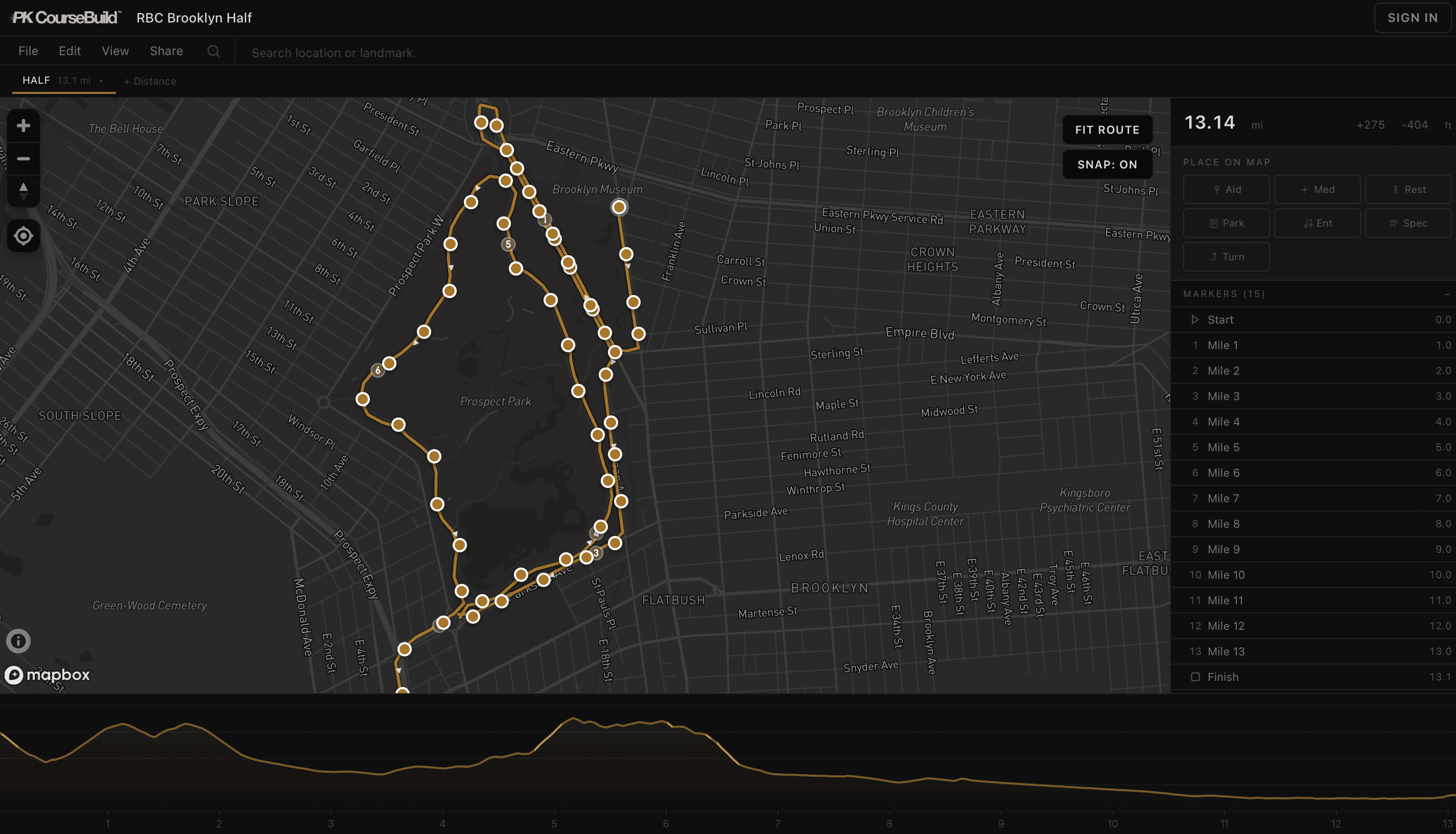
Draw your route. Upload a GPX. Elevation, mile markers, and aid stations fill in automatically. Export a clean file or embed the map on your race website.
Everything you need. Nothing you don't.
Route drawing, elevation, waypoints, export, and embedding. One editor.
Road-snapped drawing
Click waypoints on the map. Route auto-follows streets. No point-by-point plotting.
Auto elevation profile
Elevation fills in as you draw. Grade-colored chart shows every hill on the course.
Auto mile markers
Markers drop at every mile automatically. No manual placement.
GPX / KML import
Already have a file from driving the course? Upload it. Edit from there.
Aid station editor
Click to place water, medical, restrooms, parking, spectator zones.
Clean GPX export
Download a file that works on Garmin, Apple Watch, Strava, and RaceJoy.
Embeddable map
One line of code on your race website. Interactive, responsive, branded.
Course page for runners
Shareable link with map, elevation, and every detail your runners need.
Year-over-year
Course changed? Log in, adjust the section, re-export. 30 seconds.
Three steps. No learning curve.
You know your course. We handle the rest.
Draw or upload
Click the map to draw your route. It snaps to roads automatically. Or upload a GPX/KML you already have.
Edit and place
Drag to adjust. Add aid stations, medical, parking. Mile markers and elevation are automatic.
Export everything
Download GPX. Copy embed code. Share the course page link. Done.
Simple pricing.
Free to build. Pay once per race if you want pro features. Not a subscription.
Competitors charge $200-400+ for what Pro includes.